Landslide risk represent the damages and losses caused by this phenomenon. It is a measure of the probability and severity of landslide occurrence to health, property or environment. It depends on the magnitude (associated to its probability of occurrence) and the effects on the exposed elements (associated to its degree of vulnerability). Landslide risk is usually mapped combining landslide hazard and vulnerability (of elements at risk). Countless methodologies for landslide hazard assessment and many others for vulnerability are found in the scientific literature.
In some of my works I have applied well established (in the scientific literature) physically-based models (e.g. TRIGRS, SHALSTAB) for landslide hazard assessment and novel-interesting approaches (e.g. T-model) for vulnerability analysis. These are some of my research articles:

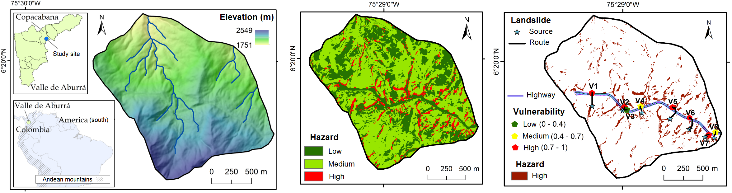
Figure 1. Location of study site (Copacabana, Colombia) for landslide hazard and vulnerability assessment (Marín et al., 2020).